Capitol Hill
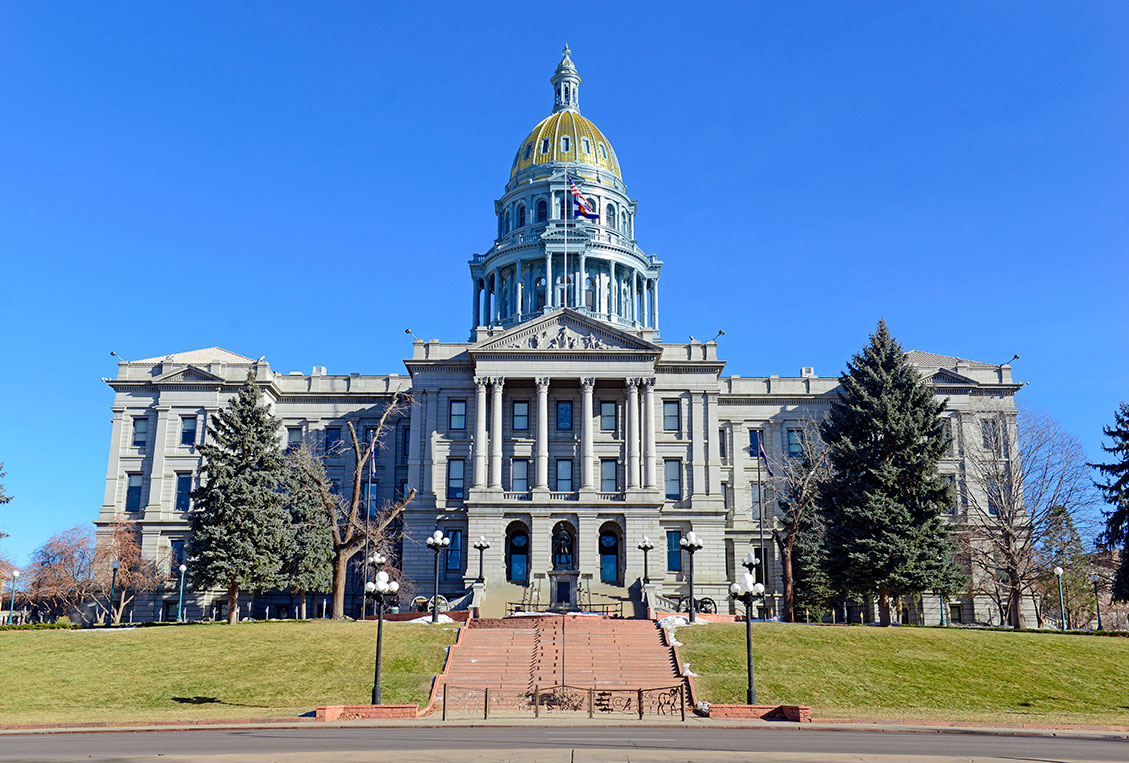
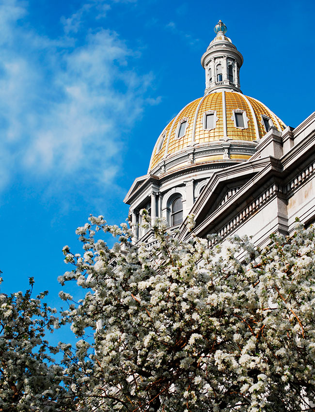
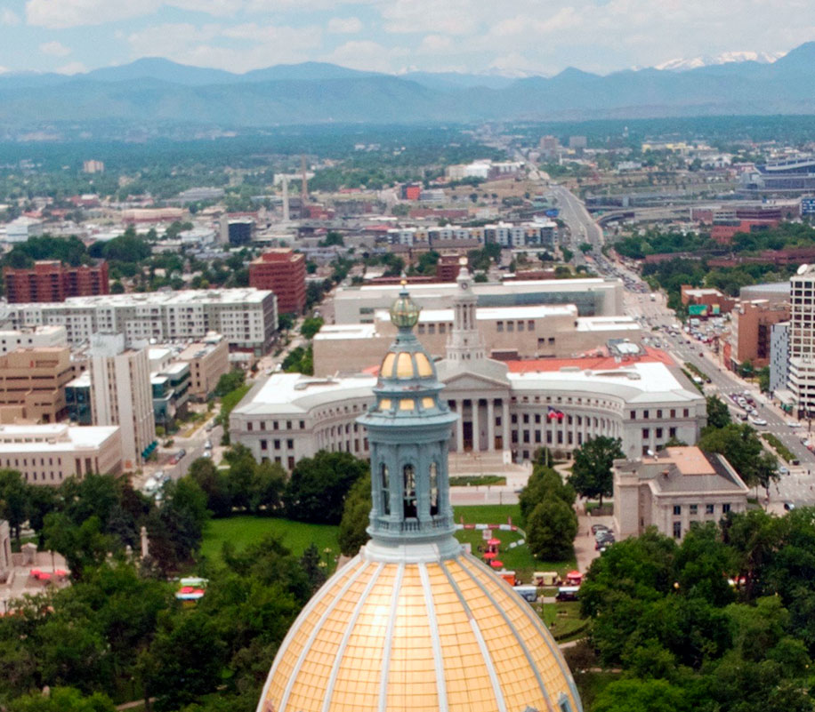
This neighborhood offers a vibrant mix of arts, culture, and Colorado history. Explore the gold-domed Colorado State Capitol with its “Mile High” marker on the thirteenth step. Civic Center Park plays host to live music and food trucks Tuesdays, Wednesdays, and Thursdays from May-October. You’ll find some of Denver’s finest museums nestled among the beautiful turn-of-the-century mansions of “Cap Hill,” including the Molly Brown House Museum, which tells the story of “The Unsinkable Molly Brown.”
Capitol Hill runs from East Colfax Ave to East Seventh Ave and from Broadway to Downing Street. Nearby, in the Golden Triangle Creative District, don’t miss the Denver Art Museum, Kirkland Museum of Fine & Decorative Art, and the Clyfford Still Museum. With galleries, fine-art studios, museums, specialty stores, restaurants, nightclubs, coffeehouses, and cafes, the neighborhood is a great place to explore on foot.
 Capitol Hill Demographics
16,120
Total Population
Denver Population: 706,799
34.7
Median Resident Age
Denver Median Resident Age: 35.5
$49,134
Median Income Per Resident
Denver Median Income Per Resident: $53,437
$62,192
Median Income Per Household
Denver Median Income Per Household: $85,721
$958
Median Rent
Denver Median Rent: $1,143
$339,727
Median Home Value
Denver Median Home Value: $513,621
22.7%
% homes owner occupied (vs. renter)
Denver % of homes owner occupied (vs. renter): 46.4%
95%
% homes occupied (vs. vacant)
Denver % home occupied (vs. vacant): 94%
 Public Safety
Denver Police District 6
Address: 1566 N Washington St.
Phone:720-913-2800
Community Resource Officers
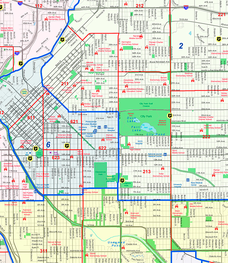
Denver Police Districts Map
The map above shows the outline of Police Districts 2, 3 & 6 within the boundaries of Denver District 10.
Capitol Hill – Year Home Was Built
Data for Year Home Was Built-Capitol Hill Compared to Denver
| Year Home Was Built | Capitol Hill | Denver |
|---|---|---|
| Before 1939 | 32% | 18% |
| 1940 – 1949 | 6% | 6% |
| 1950 – 1959 | 16% | 14% |
| 1060 – 1969 | 18% | 11% |
| 1970 – 1979 | 11% | 13% |
| 1980 – 1989 | 4% | 8% |
| 1990 – 1999 | 4% | 7% |
| 2000 – 2009 | 4% | 11% |
| 2010 – 2013 | 5% | 13% |
| After 2013 | 0% | 0.3% |
Capitol Hill – Resident Ethnicity
Data for Resident Ethnicity-Capitol Hill Compared to Denver
| Resident Ethnicity | Capitol Hill | Denver |
|---|---|---|
| White | 73.9% | 57.5% |
| Hispanic | 13.4% | 27.4% |
| Black | 3.2% | 7.5% |
| Asian | 4.2% | 3.1% |
| Other | 0% | 0.3% |
| Two or more | 5.2% | 3.7% |
Capitol Hill – Resident Education Level
Data for Resident Education Level-Capitol Hill Compared to Denver
| Resident Education Level | Capitol Hill | Denver |
|---|---|---|
| Bachelor or higher | 65% | 53% |
| Some college | 21% | 22% |
| HS grad or Equiv | 10% | 16% |
| Less than HS | 4% | 10% |
Capitol Hill – Resident Age
Data for Resident Age-Capitol Hill Compared to Denver
| Resident Age | Capitol Hill | Denver |
|---|---|---|
| 0 to 9 | 1% | 11% |
| 10 – 19 | 1% | 10% |
| 20 – 29 | 32% | 18% |
| 30 – 39 | 32% | 21% |
| 40 – 49 | 14% | 14% |
| 50 – 59 | 10% | 10% |
| 60 – 69 | 8% | 9% |
| 70 – 79 | 3% | 5% |
| 80+ | 1% | 3% |
 Registered Neighborhood Organizations
Capitol Hill United Neighborhoods, Inc.
Website: https://chundenver.org/
President:Travis Leiker
Contact Number: 303-830-1651
Email: chun@chundenver.org
Neighbors for Greater Capitol Hill
Website: https://www.neighbors4caphill.com/
President: Brad Cameron
Contact Number: 303-832-4282
 Capitol Hill History
Ever since its humble beginnings as a prairie bluff overlooking the fledgling mining camps of Auraria and Denver City, the Capitol Hill neighborhood has seen its fair share of resident characters over the years. Henry C. Brown, the man who would go on to build the Brown Palace Hotel, arrived in Denver in 1860. He utilized the Homestead Act of 1862 to claim a large tract of land that would become the westernmost section of today’s Capitol Hill. After Denver was designated the seat of the state government in 1867, Brown donated the land on which the Capitol was built. A man named John W. Smith also homesteaded a large plot of land in the area, just east of Brown. In 1864, Smith embarked on an ambitious project, digging a 25-mile irrigation ditch from the South Platte River all the way to the area now known as City Park. Access to water was vital, which allowed the area to thrive.
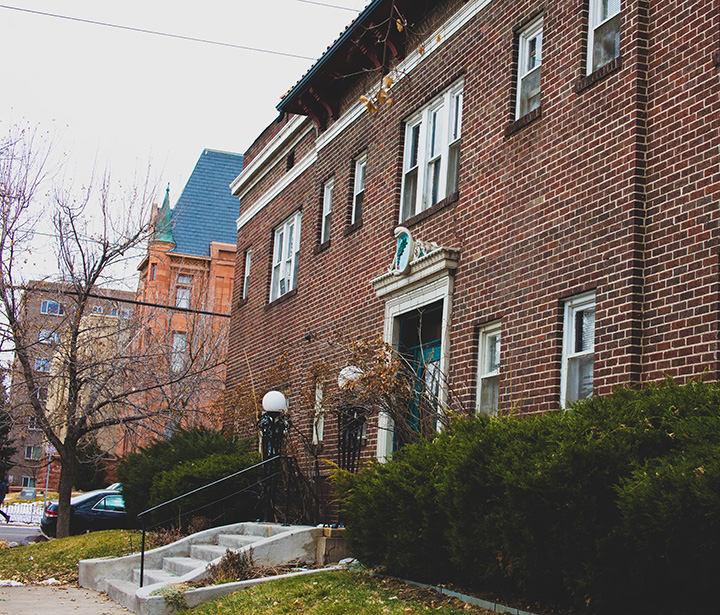
The Capitol Hill neighborhood became an escape for the wealthier citizens who could afford the unobstructed views of the front range. So many large mansions were built along Grant Street that the area became known as Millionaire’s Row. From silver barons to philanthropists, with names like Campion, Cheesman, Mullen, Sheedy and Tabor, they all had homes of distinction in this desirable locale. The Silver Crash of 1893 and the depression that followed was a pivotal moment for the evolution of the neighborhood. Extravagantly decorated Queen Anne Richardsonian Romanesque mansions were a thing of the past, giving way to the understated dignity of the American Foursquare, known locally as the “Denver Square”. In addition, with easy access to downtown provided by the streetcar network, upper middle-class residents began moving out from the city center. In the post-Victorian era, modest homes and apartment houses began to cluster amidst the older mansions.
The Capitol Hill neighborhood and its historic districts have some of the most iconic structures in the city, from the State Capitol Building (1894) to the Molly Brown House Museum (1889). In addition to an extensive inventory of historic houses, the neighborhood also boasts several historic schools and churches. Two prominent school buildings were designed by Denver architect Robert Roeschlaub, which were the Emerson School built in 1885 and the Corona School (now Dora Moore), built in 1889. Towering over Colfax sits the Cathedral of Immaculate Conception (1912) in all its Late Gothic Revival splendor, designed by architects Leo Coquard, Aaron M. Gove, and Thomas F. Walsh. Not far away, on East 14th Avenue stands another impressive house of worship in the Late Gothic Revival style, the Cathedral of St. John in the Wilderness, (1911). The neighborhood has continued to evolve over time and though some historic buildings have been lost, the eclectic mix of old and new seems to work, making the neighborhood one of the most beautiful and unique places in the city.
This content was prepared by local non-profit Historic Denver, Inc., with excerpts from the organization’s Historic Denver Guides series and other research. Historic Denver was founded in 1970 and provides technical assistance to owners of historic properties, conducts research, advocates for preservation, and owns and operates District 10’s own Molly Brown House Museum at 1340 Pennsylvania. For more information, or to get answers to your historic home questions, visit www.historicdenver.org.
Read more about Capitol Hill History
The Capitol Hill Neighborhood is bounded by East Colfax Ave to the north, Broadway to the west, Downing Street to the east, and East 7th Ave to the south.